
There are flowers that bloom in gardens
Under a gardener’s care,
And their lavish beauties charm me,
As they flourish in luxury there.
There are flowers that blow in the meadows,
Kissed by the rain and the dew,
In a riot of happy blooming,
And I love their loveliness too.
But the flower that fills me with comfort,
And makes Life’s meaning sweet,
Is the flower that blooms in the desert,
In the midst of sand and heat;
Whose roots draw strength and beauty,
From a land forbidding and wild,
Whose face turns bravely skyward,
Nor pines for lot more mild…To a Desert Flower by Hattie Greene Lockett, American writer, rancher, and clubwoman (whatever the hell a clubwoman is).
Our results showed that from 4.5 million years ago, the arid regions of Mexico were the locations for abundant cacti speciation. From these lands, cacti have colonized most of the Mexican territories, the southern regions of the United States, as well as the Caribbean. Delil A. Chincoya, Salvador Arias, Felipe Vaca-Paniagua, Patricia Dávila, and Sofía Solórzano, Phylogenomics and Biogeography of the Mammilloid Clade Revealed an Intricate Evolutionary History Arose in the Mexican Plateau
Our garden is in full bloom, or, at least, as full a spring bloom as we are going to get this year. It got warm early, and everybody started growing, stretching, seeking the sun’s warmth, then it got cold, and everybody hunkered down, confused, including me. I left out several plants I had taken from the greenhouse where they had spent the winter, and they were especially unhappy. One, a Pachypodium – a very succulent member of the Oleander family – even committed harakiri.
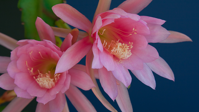
Even with everything else blooming, like Hattie, the clubwoman from Arizona, I am most fascinated by the small cactuses in pots on a table on our deck.

Cactuses like the Paraodia, below, which grow at about 1,000 feet to 2,500 feet on the eastern slopes of the Andes in northwestern Argentina and southwestern Bolivia.


And Mammalarias, which grow primarily in Mexico but have spread to Central and Southwestern United States, to Colombia, and the Caribbean.


